|
MT SCOTT AND MT SHACKLETON FROM BASE CAMP PELAGIC AUSTRALIS - FEB 2010
Not quite like in the America’s Cup, but the Swiss have again left their
lakes and are out on the ‘briny.’ In February Pelagic Expeditions hosted a
six man team of Swiss Italian mountaineers for a 30 day ‘sailing to climb’
expedition on the Antarctic Peninsula. This was by and large the same group
we had on Pelagic Australis during October 2007 for the Shackleton Traverse
on South Georgia, so they knew what they were in for on the crossing of the
Drake Passage.
It is an accolade to have such loyal clients, now friends, coming back again and again for these Pelagic adventures. But they don’t trust me in one regard – they insist on supplying the wine, the parmesan and prosciutto . . . and they always bring their own cheese grater . . . .
The Elephant Island gambit took us far out to the east, but made for an easy crossing with the wind on our starboard quarter. Never-the-less, sea sickness is always an issue, often with self proclaimed ‘yachtsmen’ going down, more so with mountain people. On these trips it is a fact to endure, an exquisite torture and my theory is that it heightens the euphoria of the arrival on the Peninsula. When back in sheltered water, the victim at once feels like life is worth living again. Needless to say, when I expound upon this observation, while still in mid Drake, it is usually not well appreciated. Three days later, spent reaching and running in benign conditions, we found ourselves just to the northwest of Elephant Island – and as the Grib files portended, a strong easterly filled in making the passage via the north side of the island untenable. The objective was to land on Point Wild on the north coast, where Shackleton’s men camped while he and five others made their famous open boat journey in the James Caird to South Georgia.
We ducked around the western end of the island, hoping for a lee on the southern side, but it was equally as savage. After fighting wind and breaking waves for some hours, we decided to abort the attempt. In any case, a landing on the open beach in these conditions, which was forecasted to persist for several days, would be a non starter. Making best use of what limited time we have is key to a successful cruise, so the decision was easily made to run downwind through the Bransfield Strait and into the Gerlache area for better weather in the central part of the Peninsula.
The mountain objectives we had in mind were Mt Scott and Mt Shackleton, two
desirable peaks in stature and in name. After several years of marketing
this Scott/Shackleton combination as a focus for climbers during our ‘Ice
with Everything’ cruise, we would finally be putting the concept to the
test.
After sorting out the mountain gear, we took a half day ski tour on the majestic Weincke Island to acclimatize to the Antarctic conditions, in addition to stretching our legs and getting the blood flowing again after the sea voyage. On land, in the mountains, on a glacier, clicked in to skis, the Swiss perked up and were as expected euphoric (my theory held true).
On February 7th, taking advantage of the settled weather, skipper Stewart Richardson encouraged us to make an early start the next morning, sail south for 25 miles and go for Mt Scott, the ‘soft touch’ of our two objectives. Lying at the southern end of the well known Lemaire Channel (aka Kodak Valley) along the Penola Straits, Mt Scott is really a hairpin shaped massif with its open end facing southwest, with several summits of interest along its spine. The harder, technical climbs are on the southwest end of the northern loop, but the true summit of 860 meters is at the head of the glacier to the northeast, and this is the popular ski mountaineering route that we would take.
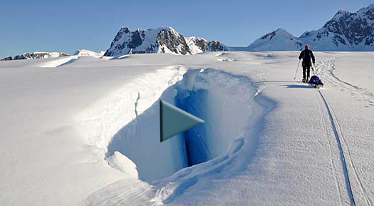
We landed on the shoreline rocks below a steep glacier at 0900. The ascent with crampons and skis on our backs took an hour, crossing a bridged crevasse to gain the main glacier. We then we enjoyed a beautiful, crevasse free ski to the summit favouring the right side of the glacier, giving a wide berth to a battery of spectacular hanging seracs along the summit ridge to our left. Four hours later we were on the summit. A flat, ethereal, light changed the landscape of snow capped islands and lesser and greater summits along the Peninsula into a white and mauve bi-chrome canvass, bereft of depth of field.
It began to snow, so we quickly repacked the snacks, peeled off skins from
skis and passed the Armagnac flask around for the last time before high
tailing it down below the cloud we now found ourselves in. Luckily, the
visibility held for a superb ski - making turns along our uphill track in
perfect snow conditions down to the snow bridge.
The Grib files again showed stable weather in the offing so our optimism was
soaring. We anchored not far away at the Vernadsky Station, an active
Ukrainian research base that was purchased from the British (then Base
Faraday) in 1996. This is where the ozone hole was first discovered over
forty years ago and the Ukrainians still maintain and take manual readings
every few hours from the original Dobson Spectrometer that is a contraption
right out of Dr. Who. Mounted on the ceiling, it shoots its signal through a
sliding hatch in the roof of the attic. The operator, which might be a young
Sergie, Alexey or Dimitri sleeps in the garret next to his machine.
Mt Shackleton would require some days of camping, so food, fuel, tentage and climbing equipment all had to be considered carefully in order to minimize the weight we would be pulling in our pulks. There are two approaches to Mt Shackleton which lies roughly 10 kilometers from the coast, and we had to get this right. Romolo opted for a day’s recce to climb Mt Mills, hard by the coast, which from it’s high ground would give us a view up the Wiggins Glacier to the south of Shackleton. From the map, this was the most logical approach.
During a mornings stroll on skis we managed to get near, but not on the
summit of Mt Mills, due avalanche risk in soft snow and an impassable snow
bridge at the bergshrund. But a clear view up the Wiggins Glacier confirmed
this was the way to go. That afternoon, we man hauled the fully loaded pulks
up the steep start at the landing place and cached them on easy ground so we
could make a fast start the next day.
With mixed feelings we came across and followed for a time a descent track left behind from a French team that had climbed Shackleton only a few weeks before. That track disappeared to the right and we stayed left and went straight for the base of the east ridge. Throughout the day, we had the southeast face of Shackleton towering above our left shoulder. Nine hours after leaving the shore, we arrived below the icefall at the corner of the ridge, and made camp.
The icefall was the usual ‘sting in the tail’ of what otherwise looked to be a straight forward ridge climb to the summit. The option was to make a wide circuit to the right (what the French had done on descent) in order to double back to the ridge. After a short respite Romolo, Carlo, Sergio and I went on a ‘recce’ leaving the others at the camp. After several cul de sacs ending in heart stopping void spaces, we managed to find a route with the crux being a very precarious bridge that partially collapsed with every passage. Now on safe ground, we pushed on up the ridge, negotiating several crevasses that spanned the entire face, luckily bridged in places. One overhanging crevasse was tackled by Romolo by cutting an ice window hatch through the roof! To make a long story short, the recce turned into a summit bid and by 1900 we were on the top.
On the way down, the last person on the rope crossed the collapsing bridge for the last time, and we were back at the camp by mid afternoon, everyone’s summit desires assuaged at last.
Next day we made a quick, but careful ski descent reigning in the pulks with back ropes all the way down to the shore. Pelagic Australis was standing by at anchor and Swiss Chris was there to meet us in the Zodiac. After a champagne toast to our selves on the beach (we carry plastic champagne glasses for such occasions) followed by the Zodiac ride to the vessel, we had a quick pow wow and decided to strike south into Crystal Sound and possibly further south to Marguerite Bay, via ‘The Gullet.’ The weather was still holding and this was an opportunity to make the run, while the mountain team took a break.
We steamed through the night, the next day, and by the following evening with no ice of consequence on the horizon we entered The Gullet – a narrow and spectacular passage between the Arrowsmith Peninsula of the mainland and Adelaide Island - the gateway that leads to Marguerite Bay.
On average, The
Gullet is rarely open as both north and south entrances to the strait are
wine bottle shaped which with help from wind and tide gather and concentrate
vestiges of last years sea ice and brash forming plugs. Un bouchon is a more
descriptive word in French that could be applied to a bottle, a traffic jam
on the peripherique around Paris or – an ‘ice jam’ in The Gullet.
In 1991 I must have skied underneath Giles – we were in a snow storm and of course never saw the grave site. Then in 2001 I was asked to take Nancy Kershaw, Giles 79 year old Mom, to the grave on board the Pelagic. She had been trying to make this pilgrimage for over 10 years but could never land by air on the Jones for one reason or another. With Pelagic w e got her within a mile of the grave, but by then the Jones had down wasted and ablated into a labyrinth of ridges and melt pools and was too unsafe to cross by foot or ski. In 06/03/2005 Jerome Poncet’s Golden Fleece was the first vessel to transit what was now called Jones Sound. Global warming, by whatever mechanism you attribute it to, had completed its work.
This year it was ice free. It took some time to find the grave as there are
similar sill and dyke structures on every buttress of the massif and we had
no exact GPS position. We finally found it – the cross, with the vertical
post still standing after 20 years just visible with the binos. Romolo,
Chris, Swiss Chris and I made the scramble over steep and loose rock to the
cairn, what must have been 80 meters above the water. A stainless steel
plaque is affixed to the rock above the grave with the inscription Giles
Kershaw - 1948 – 1990 - “Guardian of the Solitude.” And so he is, rarely
visited. After sitting in silence for some time with a view ‘to die for’
Romolo and I left a carabiner and a climbing sling on the cross and with
the others made a careful descent.
Our trip back north along the Peninsula evolved into a wildlife tour, as the
good weather we were lucky to have had, slowly deteriorated, signaling the
end to our mountaineering adventures. We arrived back in Ushuaia on February
28th, the Swiss having survived yet another Drake Crossing. We were now
looking to the big winter trip coming up – watch this space . . .
|
|||||||||
|
www.pelagic.co.uk Site Homepagee © Pelagic 2003. All rights reserved.. |
|||||||||
.jpg)
.jpg)
.jpg)
.jpg)
.jpg)
.jpg)
.jpg)
.jpg)
.jpg)
.jpg)
.jpg)
.jpg)
.jpg)
.jpg)
.jpg)
.jpg)
.jpg)
.jpg)
.jpg)
.jpg)
.jpg)
.jpg)
.jpg)
.jpg)
.jpg)
.jpg)
.jpg)
.jpg)
.jpg)
.jpg)
.jpg)